


| Protected Areas |
 |
 |
 |
| GIS Layers, Resources, Protected Areas | |||||||||||||||||||||
| Monday, 18 January 2010 15:03 | |||||||||||||||||||||
|
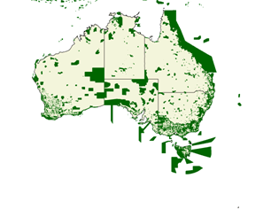
Description
The World Database on Protected Areas (WDPA) is project of UNEP and UICN. This global spatial dataset on marine and terrestrial protected areas was produced and updated by UNEP-WCMC and the IUCN World Commission on Protected Areas. The WDPA is a conservation decision making tool designed with important information from national governments, non-governmental organizations, academic institutions, international biodiversity convention secretariats and many others.
A protected area is:
Source: Dudley, N. (Editor) (2008). Guidelines for Applying Protected Area Management Categories. Gland, Switzerland: IUCN. x + 86pp.
For more information on the IUCN protected area definition please see here.
The World Database on Protected Areas (WDPA) http://www.wdpa.org/ : is the most comprehensive global spatial dataset on marine and terrestrial protected areas available
The World Database on Protected Areas (WDPA)
Conservation Commons – see terms of use http://www.wdpa.org/TermsAndConditions.aspx
|
|||||||||||||||||||||
| Last Updated on Wednesday, 17 November 2010 10:07 | |||||||||||||||||||||

About Us
Funding
Resources
Noticeboard

